Flood Risk Assessment - Hydrology Study
We are able to design storm water drainage for the most complex topographies while also providing remedial measures for the same. B.R. Archstruct has a team of specialist engineers who are highly experienced at conducting flood risk assessments for several projects across the globe in various geographies.
B.R. Archstruct also investigates if a lack of an appropriate and adequate drainage system has a direct or indirect impact on power generation and results in operating income loss; we are aware of its importance and impact on the power plant, as well as the frequency with which floods may occur. We also look at whether there are any other options for mitigating or reducing flood risk besides installing a drainage system, as well as whether the drainage system is possible and, if so, how much it will cost.
We then collect meteorological data (satellite based), topographical data for the plant area and satellite based data for areas beyond the plant boundary, historical flood data at the project site (based on public domain information and information gathered during site visit), and analyse and interpret the collected data as needed to complete a hydrology study. While conducting this research, local standards or norms are referred to.
Ability to do hydrology studies and flood risk assessments for operational plants, as well as full Bill of Quantity costing and construction support.
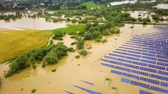
We have industry-based software that helps assess project risk and perform hydrological modelling with 1D and 2D model linking. Solar PV projects are susceptible to Pluvial and Fluvial flood risk from nearby rivers or direct rainfall.
Provide technical specifications and checklists for conducting a site survey of barren land and operational plants, as well as conducting a flood risk assessment.
We provide mitigating methods for utility-scale solar PV plants as well as infrastructural factors such as road heights to prevent floods on roadways and plant accessibility.
Experience conducting hydrological investigations in a variety of topographies.
We give rainfall intensity comparisons for multiple rainfall datasets in our flood risk assessment, which can be used in greater detail.
Our
Services
A Hydrology report with recommendations for reducing flood hazards is the deliverable. As part of the detailed technical scope, we also design and plan storm water drainage systems. The following are included in the hydrological study:
- The purpose of a site visit is to gain a better understanding of the current site conditions, as well as to examine topographical features in order to better comprehend natural drainage and land use patterns.
- For areas beyond the plant boundary, satellite-based data or, if accessible, drone survey data is employed. There may be differences between PV plant topography data and satellite or drone data, resulting in elevation mismatch along the intersection of both data sets and affecting analysis accuracy.
- Prepare a flood inundation map that shows the flood levels, inundated area, and flow direction, taking into account the site topography, soil conditions, and other factors, and using the above flood hydrographs as upstream and downstream boundary conditions.

- For the project site, collect satellite-based rainfall data (hourly, daily, annual, etc.) or openly available data from CWC. If data from the gauge station is accessible, it can be used for further study.
- Analyze the rainfall data and calculate the maximum rainfall depth for 24 hours and other short periods, such as the duration of concentration for 25, 50, and 100 years. The report includes rainfall data as well as an analysis.
- Preparation of watershed based hydrological model;
- Manning's coefficient and runoff coefficient analysis.
- Prepare an Intensity-Duration-Frequency (IDF) curve by estimating maximum rainfall intensities for various return periods and durations, including concentration times. Runoff study and catchment area estimation
- Creating a hydrological model based on a watershed;
- Analyze the project's high flood level; implement different remedial actions, such as the installation of additional drains with appropriate sizing, if feasible.
If You Need Help Or Have Question, Get A Consultation
We are all ears! Call Us, Drop us an Email, Whatsapp Us, Visit Us Physically or just fill out the given form and we shall reach you.


